KH
KH  FR
FR  AR
AR CN
CNH.E. Neth Pheaktra: “Maps Do Not Move With Troops” and Military Force Cannot Redraw Borders
AKP Phnom Penh, August 31, 2026 --
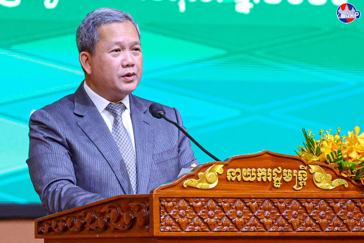
Minister of Information of Cambodia, H.E. Neth Pheaktra, emphasised in a Facebook post on Aug. 30 that military force cannot redraw Cambodia-Thailand border and urged the Thai side to respect legal framework in border issue between the two neighbouring countries.
The full message reads as follows:
“Maps Do Not Move With Troops: Military Force Cannot Draw New Borders
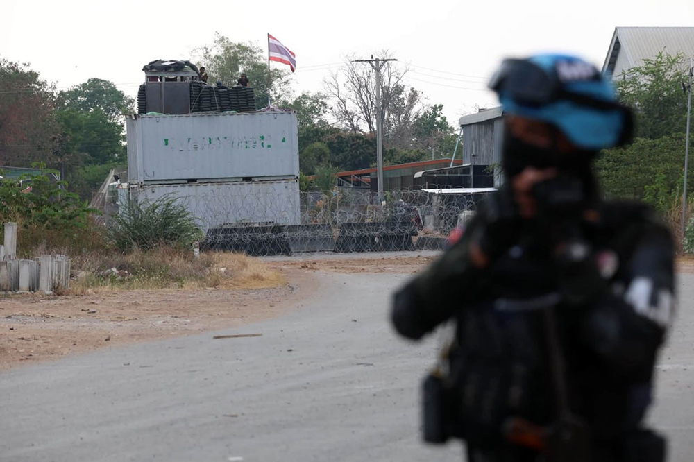
The deployment of troops, flags, shipping containers, barbed wire, the digging of trenches, or the construction of roads and other infrastructure is not a means of determining an international boundary between states. Such actions may create a physical presence or de facto control on the ground through unlawful means, but they do not automatically establish sovereignty as a matter of law. Maps do not move with troops, and borders do not shift according to where soldiers happen to stand.
This is the central point that must not be obscured in the Cambodia–Thailand border issue. Military presence at a particular location does not establish sovereignty; de facto control is not the same as lawful title; and the creation of new facts on the ground cannot replace legal instruments. The Cambodia–Thailand boundary is an international boundary whose legal foundations include the Franco-Siamese conventions and treaties.
Facts on the Ground Cannot Be Hidden
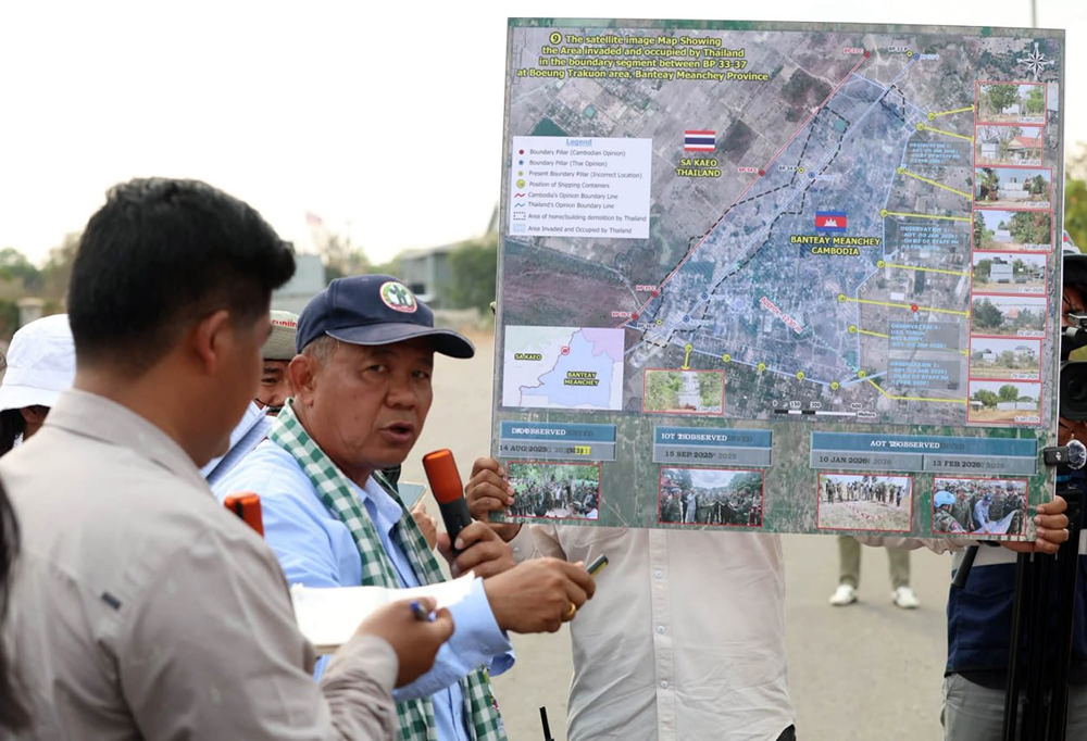
In the areas of Boeung Trakuon, Prey Chan village and Chouk Chey village, the ASEAN Observer Team in Cambodia (AOT-KH) has conducted on-site observations of the actual situation.
According to data presented by Cambodian authorities during these missions, 116 shipping containers have been deployed at 24 locations, while 13,259 Cambodian citizens from 3,318 families, including 3,416 children, have reportedly remained unable to return to their homes.
At the same time, satellite imagery has shown the destruction or clearance of at least 627 structures in Chouk Chey village, Prey Chan village and the Boeung Trakuon area following the December 2025 ceasefire by Thai forces.
The discussion therefore cannot end with statements such as, ‘We did not commit aggression,’ or ‘We are defending our own territory.’ Any such claim must be tested against a verifiable question: Are the actions on the ground consistent with the boundary and the obligations established by the relevant legal instruments?
The Ceasefire Closed the Door to Creating New Facts on the Ground
The agreement of 27 December 2025 is particularly significant. Both sides agreed to maintain their existing troop positions without further movement and explicitly affirmed that arrangements under the agreement would not prejudice the demarcation or the international boundary between the two countries. Surveying and demarcation are to continue through the Joint Boundary Commission (JBC).
If Thailand believes that a particular location belongs to Thailand, that claim must be demonstrated through relevant documents and addressed through mechanisms recognised by both sides—not through aggressive incursions into Cambodian territory or through reliance on unlawful maps.
The historical and legal foundations for determining the boundary include the Franco-Siamese Treaty of 1904 and the Franco-Siamese Treaty of 1907, together with the relevant cartographic documents. The 2000 Memorandum of Understanding (MoU), meanwhile, established the bilateral framework for the survey and demarcation of the land boundary.
Even with respect to Chouk Chey and Prey Chan villages, the two sides have agreed, through the JBC mechanism, to conduct joint surveys and install temporary markers, while explicitly affirming that those temporary markers are without prejudice to the international boundary between the two countries.
The relevant question, therefore, is not:
‘Whose troops are standing there today?’
The correct question is:
‘How do the treaties, maps, boundary-demarcation documents and results of joint surveys determine the location of the boundary?’
If there is no agreement, conduct a joint survey. If there is a difference of position, negotiate. If there are conflicting documents, verify them. If an agreed mechanism exists, use that mechanism.
What cannot be done is to use force to create the answer first, and then use the situation created by that force as the basis for negotiations afterward.
For this reason, verbal denials alone are not sufficient. If either side maintains that its actions are lawful, it should present the legal basis supporting that claim and allow the agreed boundary-demarcation mechanisms to perform their function.
Maps do not move with troops. Military presence cannot redraw an international boundary, and facts created on the ground by force cannot substitute for treaties, maps and the rule of law.”

AKP